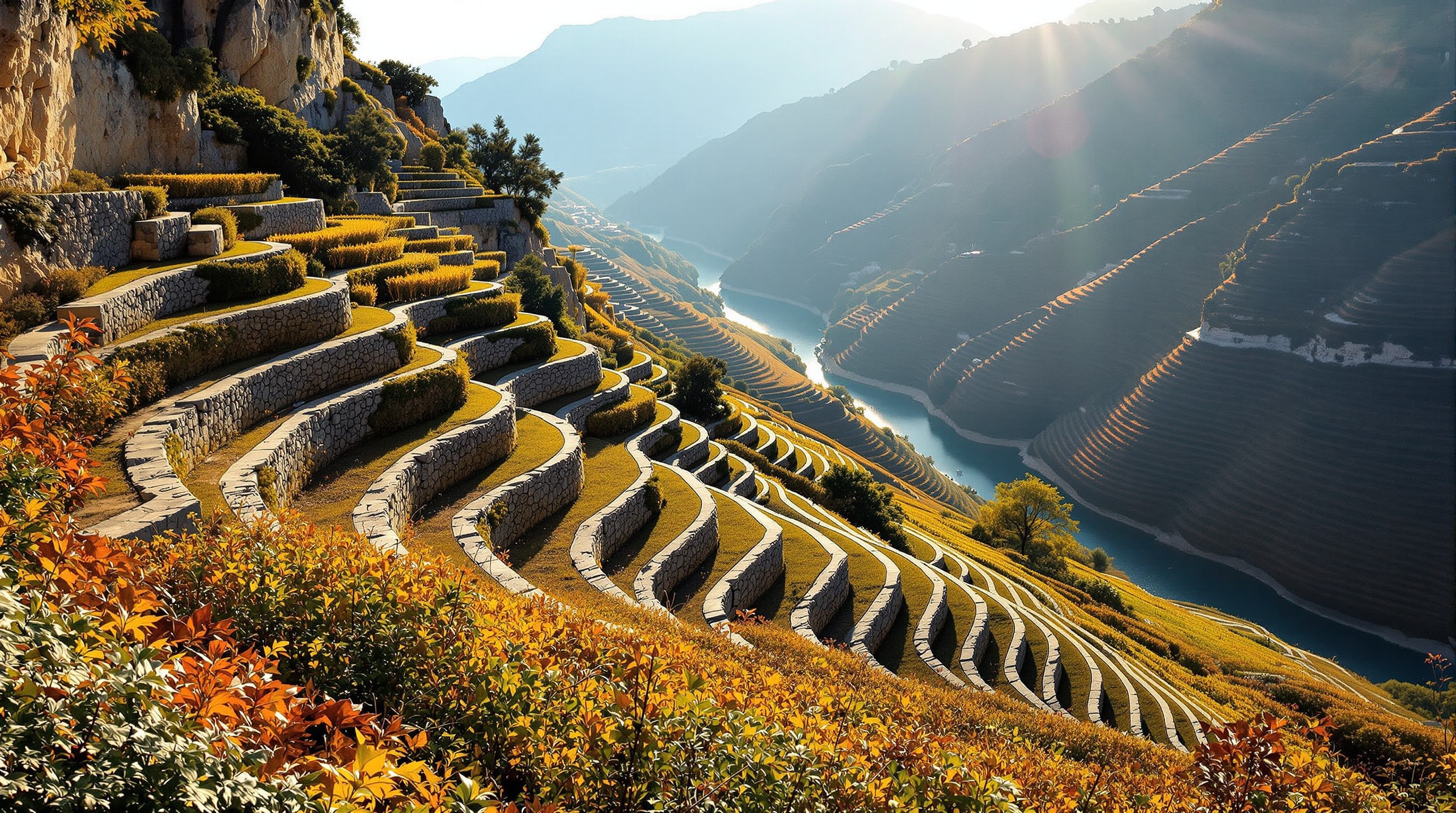
The Douro valley is the only place in Portugal where the manor house and the business are the same thing. A quinta here is a production unit — terraces, treading tanks, cellars and a house — laid out on a slope too steep to farm by any rational standard, in a climate that is freezing in winter and reaches the mid-forties in August. The result is one of the great man-made landscapes of the world.
Building the Terraces
The hillsides of the upper Douro are schist, which splits into thin plates and holds heat like a storage radiator. Left alone the slopes are unfarmable: too steep, too thin-soiled, too dry. Everything you see was made by hand.
The oldest terraces, the socalcos, are narrow shelves supported by dry-stone walls, wide enough for one or two rows of vines, built up over generations from stone cleared off the slope itself. Later systems widened the shelves and eventually — from the 1970s — replaced the walls with earth ramps that a tractor can climb. All three generations are visible from any viewpoint in the valley, and the older ones are protected under the region's UNESCO inscription.
The scale of the labour is difficult to convey. Kilometre upon kilometre of dry-stone wall, all of it built and rebuilt by hand across three centuries, on slopes where the workers had to be roped in some places. It is closer to a public work than to agriculture.
The First Demarcated Region
Port became an English staple in the late seventeenth century, when war with France cut off claret and the Methuen Treaty of 1703 gave Portuguese wines a tariff advantage. Demand rose faster than good wine could be made, adulteration followed, and by the 1750s the trade was in trouble.
The response, in 1756, was the creation by the Marquês de Pombal of a chartered company with a monopoly on the trade, together with something genuinely new: a physical demarcation of the growing area, marked on the ground with stone pillars, and a classification of vineyards by quality. This was the world's first regulated wine appellation, predating the French systems by well over a century. The demarcation is still administered — with modern refinements including a points-based classification of individual vineyard plots — by the Instituto dos Vinhos do Douro e do Porto.
UNESCO inscribed the Alto Douro Wine Region in 2001 as an evolved, living cultural landscape — that is, a working agricultural system whose value lies in its continued operation rather than in preservation as a relic.
The Architecture of a Quinta
A Douro quinta is organised by process, not by display. The buildings sit where the slope allows and where gravity helps: grapes come in at the top, are trodden or crushed, and the wine moves downward through the building without pumping.
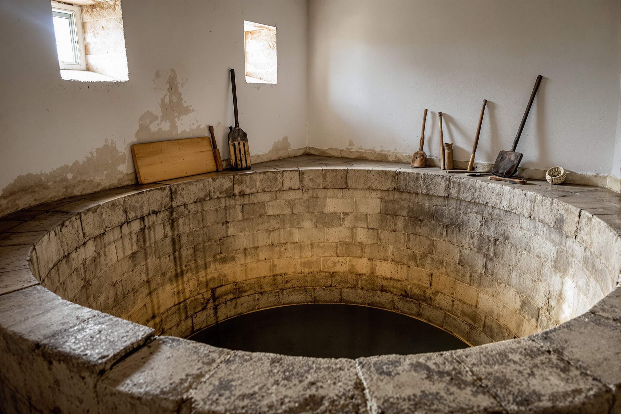
The core structure is the lagar, a shallow granite tank about seventy centimetres deep in which grapes are trodden by foot. This survives not out of romanticism but because it works: human feet break the skins without crushing the pips, and the shallow tank gives an ideal ratio of skin contact to volume for a wine that must extract colour and tannin fast before fortification stops the fermentation. Many top estates still tread their best lots.
Around it are the press house, the cellar, and the casa itself — usually white-rendered rather than bare granite, long and low, one room deep for cross-ventilation, with a deep veranda facing the river and a shallow-pitched tile roof. Where a Minho solar turns inward around a courtyard, a Douro quinta faces outward at the view, because the view is also the vineyard.
The Valley's Three Sections
The demarcated region divides into three, and they are genuinely different places. The Baixo Corgo, downstream and nearest Porto, is the wettest and most densely planted, historically producing lighter wines. The Cima Corgo, around Pinhão, is the classic heart of the region and holds most of the famous estates. The Douro Superior, running east to the Spanish border, is the hottest, driest and emptiest — a frontier that was barely planted until modern times and where the terraces give way to open, almost desert country.
Phylloxera and Its Marks
The vine louse reached the Douro in the 1860s and destroyed a large proportion of the region's vineyards within two decades. The scars are still legible: whole hillsides of abandoned terraces, called mortórios, walled and empty, some of them replanted only in the past thirty years. Recovery required grafting European vines onto American rootstock, a technique that remade viticulture worldwide and permanently changed the economics of the valley — many small growers never came back, and land consolidated into larger estates.
Visiting
The valley is at its most spectacular at the September and October harvest, and at its emptiest and coldest in January and February when the pruning is done. Late spring is green and comfortable; high summer is genuinely hot and the light is flat. The Douro railway from Porto is the classic approach, and the river itself is navigable by boat as far as the Spanish border thanks to a chain of dams built in the twentieth century.
For the region in wider context see the Douro regional guide; for the buildings, the architecture guide; and for how the region fits into a longer itinerary, the orientation page.